
https://buy.garmin.c...eProduct=113532
http://garminoregon6...es.com/Features
http://garmin.blogs....anchId=newsroom
http://www.youtube.com/watch?v=uBgBhGBe ... _embedded#
Судя по этим обзорам, нас ожидают следующие изменения:
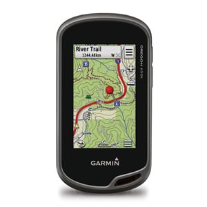
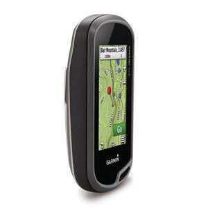
- экран с улучшенной видимостью на солнце, но с тем-же разрешением (рефлективный дисплей использует технологию внешнего света, как солнечный свет, в сочетании со светодиодной подсветкой устройства, что обеспечивает прекрасную видимость в независимости от уровня освещения).
- пропорции экрана немного изменились - он вытянулся
- двойная ориентация + акселерометр.Просмотр карты и данных в портретной или ландшафтной ориентации в зависимости от того, как аппарат ориентирован.
- расширенный профиль высот.использует картографические данные, чтобы показать вам, что вас ожидает впереди.
- улучшеный бортовой компьютер.Получите на 33% больше данных на экране одновременно с новыми вариантами компоновки. Добавьте несколько страниц полей данных, каждая из которых настраивается из 4 макетов: 2 больших, 1 большой и 4 малых, 6 или 8 малых.
- расширенный менеджер точек \ треков. Все данные отображаются и редактируются на экране длительное нажатие позволяет удалить одну или несколько точек одновременно из меню менеджера точкек.
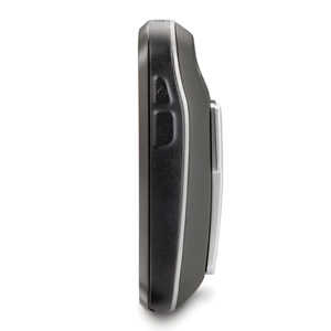
- некоторое увеличение веса
- чипсет с ГЛОНАССом
- беспроводные соединения: Bluetooth ® и ANT
Теперь вы можете осуществлять беспроводную передачу больших файлов, таких как фотографии, тайники, приключения, маршруты и Custom Maps(пользовательские карты) между Oregonами 600й-серии (или с Garmin Basecamp ™ Mobile ). Кроме того, новые технологии позволяют передать ваши маршруты, путевые точки и треки до 50 раз быстрее.
- 8-мегапиксельная фотокамера с цифровым зумом и вспышкой
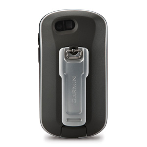
- Oregon 600-серии оснащён системой двойного питания как от встроенного перезаряжаемого NiMH аккумулятора (included) так и от обычных AA батареек\аккумов — встроенный перезаряжаемый NiMH аккумулятор заряжается, когда орегон подключён к зарядке.
- фонарик. Фонарик имеет несколько уровней яркости и режим стробоскопа\мигания - яркий и тусклый- для экономии заряда аккумулятора.
От себя добавлю: вызывает некоторое опасение экран новой компановки при падении (в предыдущих сериях экран защищен бортиком, т.е. несколько "углублен" в корпус навигатора.